AgriRoof App
Shiny application for Potential Flat Rooftop Detection using LiDAR and GIS for Rooftop Farming.
Source code
🔗 AgriRoof
Motivations
How can we establish rooftop farms 🌱🏙️ in urban areas and contribute to the optimization of resource utilization for profitable and sustainable agricultural businesses? 🚀💼
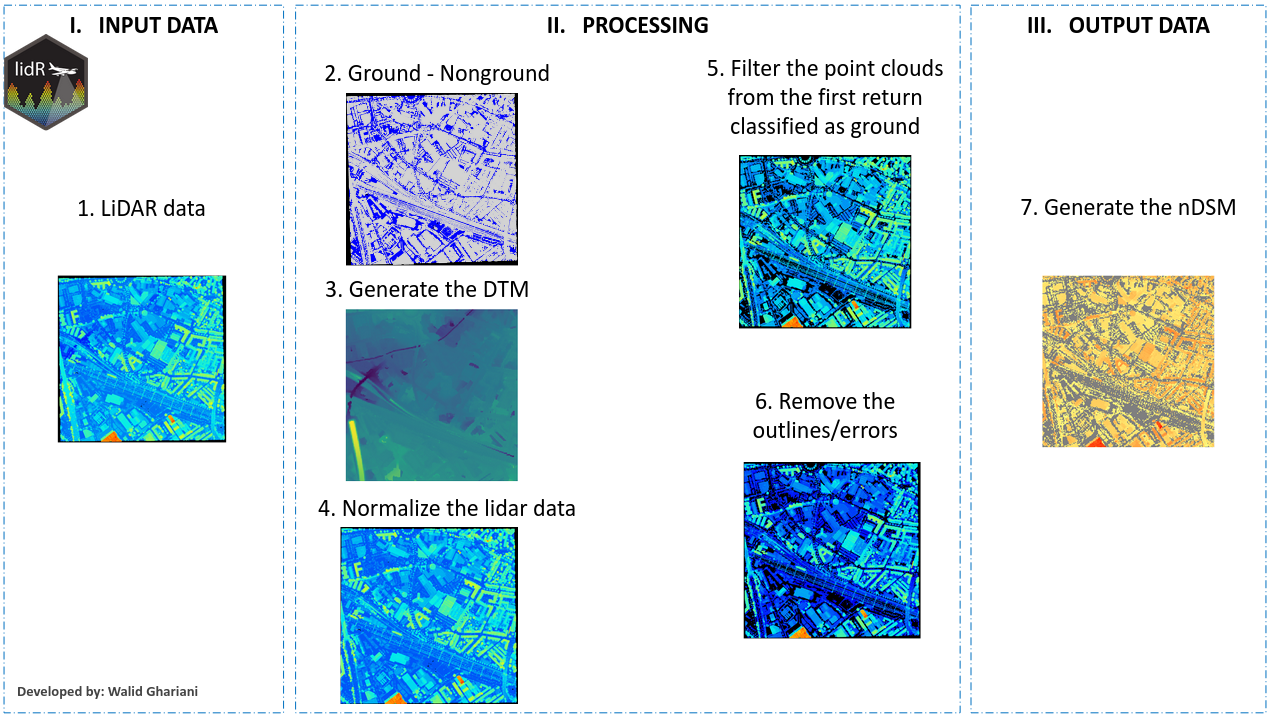
This was the topic of research during my MSc course on “Land and Water Management” for me and my colleagues. To answer this question, we adapted an innovative approach based on LiDAR and GIS data. As part of the team, I played a role in LiDAR processing and in creating the app that would support our methodology and enable efficient selection of suitable rooftops.
Description
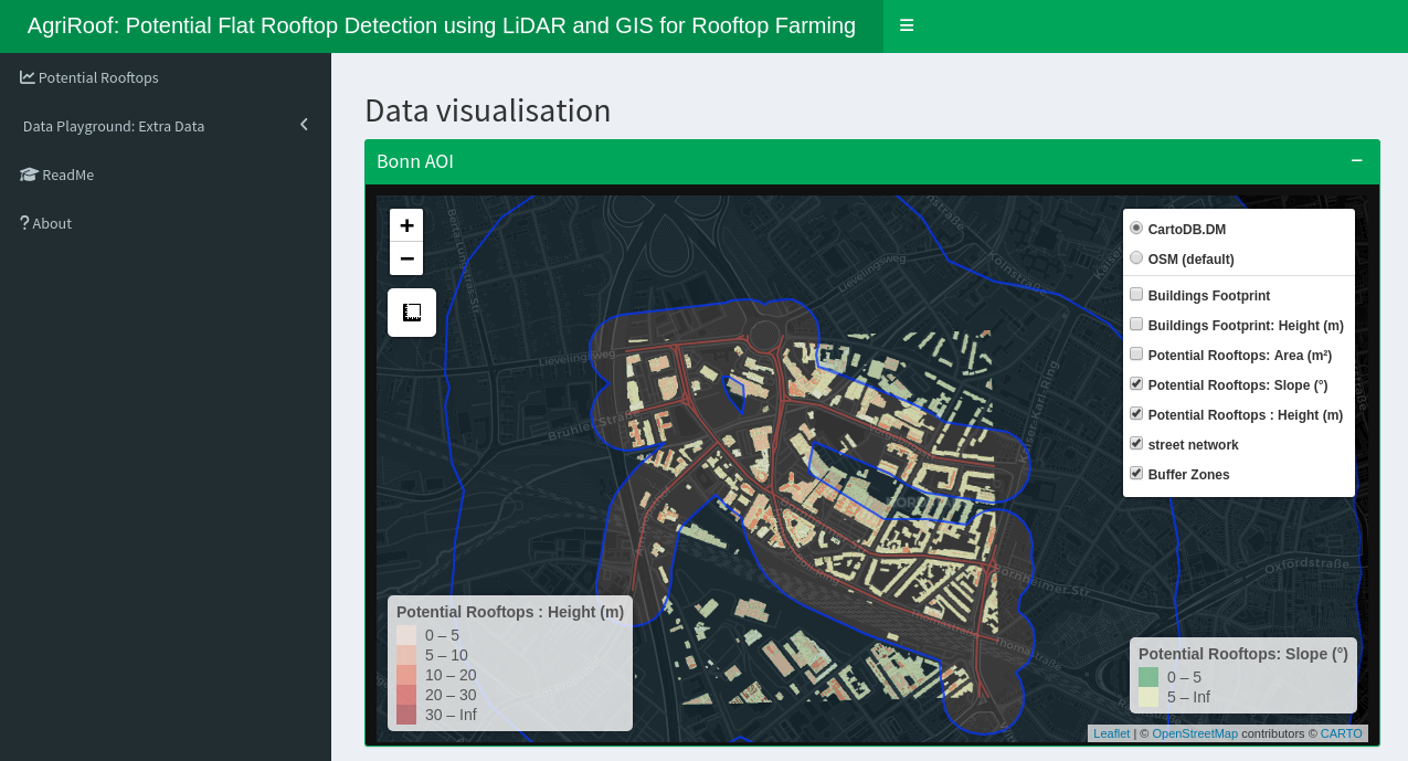
With this app we offer the possibility of finding suitable places to establish a rooftop farms in a city. Our main goal is to help our customers to save resources by evaluating the areas of interest with LiDAR and GIS data, so in the end, they can operate a profitable agricultural business. Our solution would deliver key information for local authorities, urban planners, and companies as local food markets.
LiDAR Processing


App Preview

---
Background image srource: Photo by Hannah Lim on Unsplash
---